Tips for the Cleveland Way
Last September, I walked part of the Cleveland Way, a 110-mile (177km) walk that runs between the market town of Helmsley on the edge of the North York Moors and Filey Brigg, which lies on the Yorkshire Coast. It’s a spectacular route that takes walkers through the moors and then along the coastline, allowing them to see the variety in landscape. Most walkers begin from Helmsley, but it’s just as possible to begin from Filey Brigg and end in Helmsley, if that’s what you prefer.
What do I need to know?

Map of the Cleveland Way- National Trails, UK
The first half of the walk from Helmsley to Saltburn-by-the-Sea is inland while beyond that, the Cleveland Way becomes a coastal walk.
Everything you need to know about the walk is on the National Trails website. Here, you’ll see that the walk has been divided into sections- Day One is from Helmsley-Sutton Bank (10 miles/16.1km), Day Two is from Sutton Bank-Osmotherley (11 ¼ miles/18km), Day Three is from Osmotherley-Clay Bank (10¾ miles/17.2km), and so on.
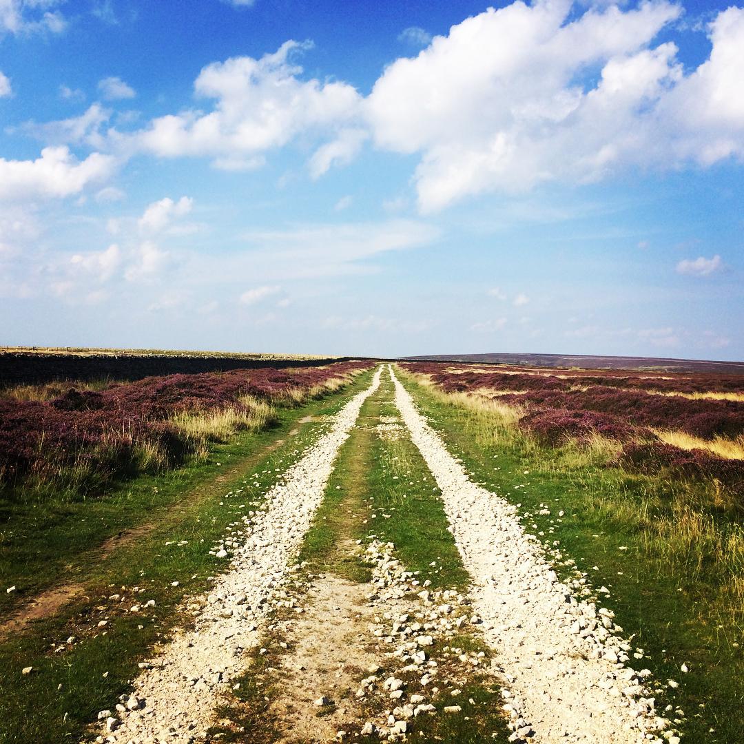
On the North York Moors. Not a soul for miles.
How difficult is the walk?
The Cleveland Way isn’t excruciatingly difficult, although some parts are challenging enough to give you a good workout. Other sections range from fairly easy to moderate. I didn’t have time to complete the entire 177km, but I was able to experience both the moors and the coast in the 55km that I walked.
How many hours of walking will I have to do every day?
How long you walk every day will depend on how fast you can go. My average speed along the Way was between 20-24 minutes per 0.6 miles (my walking app measures in metric, so it was 20-24 minutes per km), which meant that I walked for about six or seven hours a day. I didn’t rush and certainly wasn’t competing with any of the people I bumped into. One thing I did do however, was to make sure that I reached my final stop for the day before sundown.
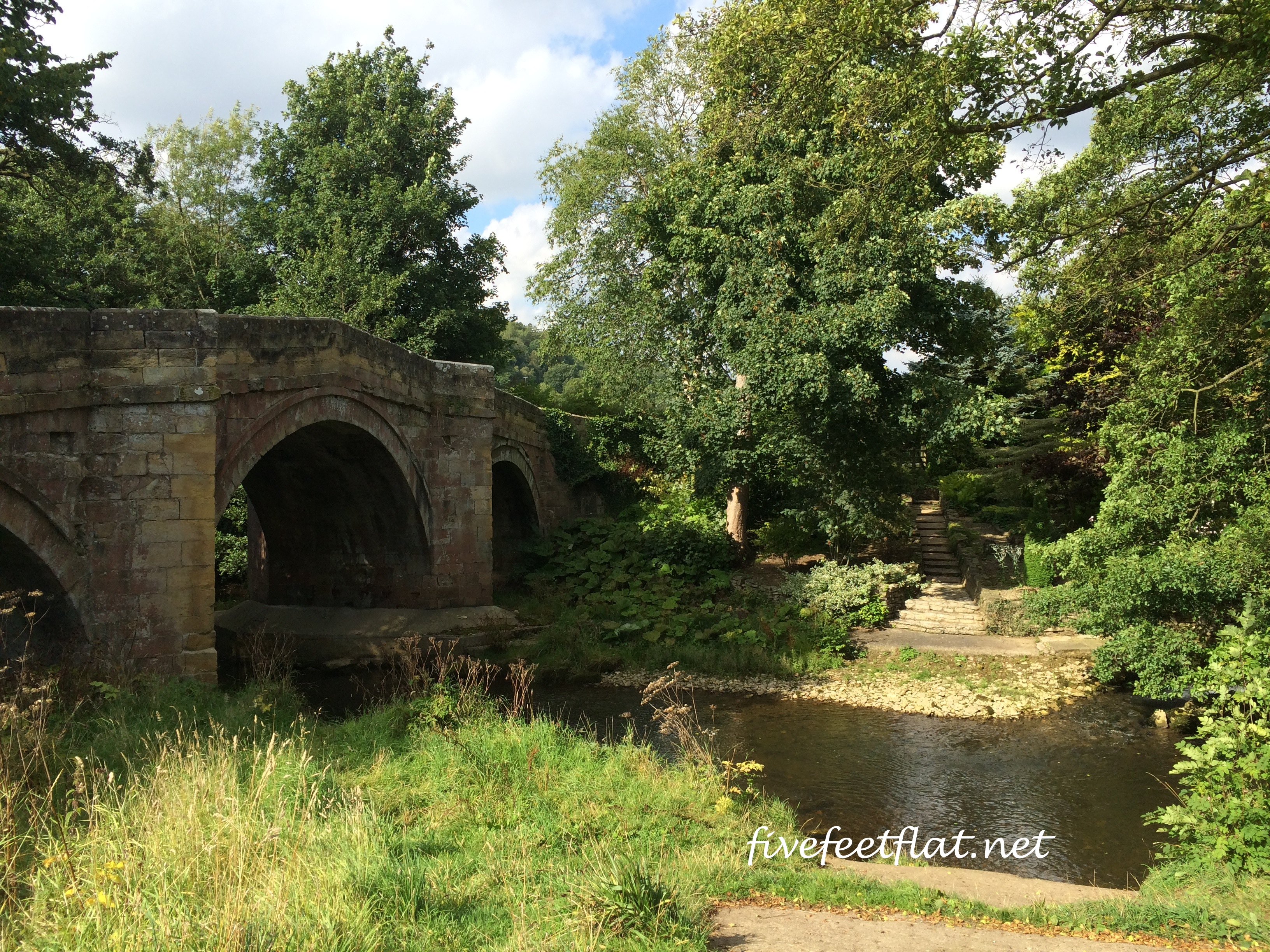
Rievaulx Bridge
Do I have to follow the day-to-day guide? Is it possible for me to walk shorter distances?
A few people have asked me whether it’s possible to walk a shorter distance on some days, and longer distances on days when they feel particularly energetic.
My reply to this is that walking distances shorter than those specified in the guide may not be possible in certain sections particularly on the first two days, simply because there aren’t enough places for walkers to sleep in along this part of the route.
The walk is divided into sections for a reason. On Day One, walkers will have to go as far as Sutton Bank (16.1km from Helmsley) to rest for the night. If there is nothing available in Sutton Bank, they’ll have to find accommodation in villages like Kilburn and Boltby which are off the Cleveland Way.
Similarly, on Day Two, there are no villages between Sutton Bank/Kilburn and Osmotherley, which means you’ll have to walk 18km to get to Osmotherley to spend the night. So in short, no, it’s not always possible to walk a distance shorter than what is set out in the guide, but it will be easier to do so after Day Three when you come across more villages and towns as you get closer to the coast.
As for walking longer distances, if you’re strong enough you can certainly cover two sections in one day.

Lots of farmland along the Cleveland Way
How much will I have to carry?
Good question. There are two ways of carrying your stuff on the Cleveland Way and on other multi-day walks: by yourself (also known as The Hard Way) or by hiring a transport company to carry your luggage, allowing you to walk around with just a small daypack (this is obviously The Easy Way).
The Cleveland Way was my first multi-day walk and I chose to do it The Hard Way because I wanted to save money, and because I wanted to push myself and see how difficult it could get. I carried a 36-litre Osprey backpack weighing 6kg for five days.
If you’d rather not carry everything, here is a list of companies offering baggage transfer services on the Cleveland Way.

Boats at Whitby
What do I bring?
Just as a guide, here are the main things I brought on the walk:
-A half-zip fleece pullover
-A waterproof and windproof shell
-Two pairs of hiking trousers
-One quick-dry t-shirt
-One merino wool camisole
-One quick-dry long-sleeved top
-A hydration bladder
-An emergency blanket, a whistle, headlamp and compass
-Walking poles
-Walking boots with ankle support
-One pair of flat slip-ons
-One pair of flip-flops
-Two pairs of merino wool socks
– A DSLR camera
– A notebook and pens
– The Official National Trail Guide on the Cleveland Way by Ian Sampson
-North York Moors Ordnance Survey Explorer Map OL26
*As with all hikes and walks, I avoided wearing cotton.

Sunset at Robin Hood’s Bay
How do I get to the start/finish points?
If you begin walking from Helmsley, the easiest way to get there would be by bus from York. Bus 31X leaves Station Avenue near York train station three times a day (0905, 1105, 1348) Mondays to Saturdays and arrives in Helmsley about 90 minutes later. If you miss the bus at Station Avenue, run like crazy like I had to and head for Exhibition Square, which is where the bus leaves ten minutes later.
If you end in Helmsley, the 31X to York leaves at 0930, 1140, 1340 and 1745. Bus times, however, may change, so go to www.traveline.info to check.
Getting to and from Filey on the Yorkshire coast will be easier. Filey has its own train station and from there, you can get to York, Hull and Scarborough quite easily.

Leaving Robin Hood’s Bay
Is it safe for women to walk alone?
Yes, it is. Although I bumped into other walkers, I walked alone every day and I was fine. As with all adventures however, be aware of your surroundings and have an emergency number close by. Also, since there is very little shelter on the open moors, try to reach your accommodation before dark and before the temperature drops.
Did anything cool happen on your walk?
Why, yes, actually- I bumped into a BBC Yorkshire television crew! Coincidentally, they were shooting a story on the Cleveland Way about how Google had begun mapping the route, so it was a pleasant surprise when BBC video journalist Carla Fowler said she wanted to interview me for ‘BBC Look North’.
I met up with Carla again a few days later in Ravenscar, where she asked me whether having the Cleveland Way mapped out on Google Trek would have made any difference for me. That interview is in a video clip here. I appear somewhere at the 1:35 mark, but do watch the whole clip for some lovely views of the walk.
Here’s a screenshot with Robin Hood’s Bay in the background:

Thanks, BBC Yorkshire. I would have been content with being described as a ‘Confused Malaysian found wandering on the North York Moors’ .
Should I do the Cleveland Way?
Absolutely. Here’s a more personal account of my walk, which I hope you’ll enjoy.
Yorkshire is a beautiful part of England but what made my walk really special were the people I met. Strangers helped to carry my backpack when I got lost and had to ask for directions, chatted with me on the bus to Helmsley, looked out for me and gave me advice on where to stay. Also –and this is very important to remember- the fish and chips in Yorkshire is better than anywhere else in the country. That’s a promise.
© 2015 – 2016, Anis. All rights reserved.


I am just wondering…is it possible to camp in the open along the way? Are walkers allowed to do so?
Yes, it is possible to camp along the Cleveland Way, both wild camp and at campsites. I didn’t see any wild campers but places like Osmotherley, Kildale, Fylingthorpe all have campsites. A few B&Bs/inns even allow campers on their grounds, so you’ll need to ask. Good luck! I’ll be walking again soon in Spain and later this year, in Scotland, so keep checking back here if you’re interested in those two places 🙂